How was the New World Discovered?
The legends that there is a lost continent beyond the ocean that nobody knows have been told from ear to ear since ancient times. The most famous of these legends was the one told by Plato about the island of Atlantis. According to a rumor reported by Plato, Poseidon fell in love with a woman named Cleito. As a result of this love, 5 twin boys were born. Father Poseidon gave each of these born boys a lot of islands and land on the ocean. The biggest of these is Atlas, which gave its name to the Atlantic Ocean, which is the ruler of Atlantis. Plato explained that at the end of the legendary event, Atlantis was buried in the waters of the ocean and sank in this way only as a result of natural disasters. After these events happened, when they saw that there were people who wanted to go to Atlantis, but the ocean was covered with mud and those who wanted to go here did not lead their ships by the muds, these sailors gave up to go here. It was believed that the location of the island of Atlantis was ahead of the Strait of Gibraltar with its present name, which was called Hercules Columns in ancient times.
This ocean was called the Atlantic Ocean for the first time by the historian Herodot. Other names believing in Atlantis other than Herodotus were Posidonius and Strabon. Philo, a Jewish philosopher, described Atlantis in the 1st century and described it as a larger island than the sum of Libya and Asia. He explained that the island completely collapsed with the earthquakes and that the sea became impassable after this sinking event. He also stated that Pope Clemens, who lived in these periods, was not able to cross this ocean with human efforts and that the laws of God were also valid on the land beyond this ocean.
It was also interesting that Clemens made such a description of the island. Information about land settlements far ahead of the ocean is also available in an ancient Iberian legend. In the legend, seven priests who managed to escape from the Muslim armies during the conquest of Spain opened onto the Atlantic Ocean by boarding the ships with their congregation. They moved to the west on the sea and eventually reached Antilles Island. They settled here and founded seven different cities.
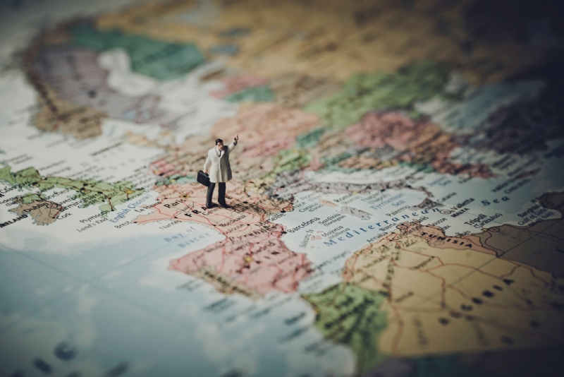
We do not know if a place called Atlantis is in the real world. However, we know well that the sailors traveled to the islands beyond the Gibraltar Strait at that time. Among these seafarers, some sailors went to the New World and came back from there. It may be thought that this legend told by Plato is perhaps nothing more than a story made by other merchants or sailors. It may also have been a legend fabricated to prevent others from reaching overseas territory. Even if there were people who managed to reach the new continent until the Age of Discoveries, this situation did not cause an effect that would change the fate of the world. Although it was stated that the New World was discovered by Columbus, 500 years before Columbus discovered it, it was used by Vikings from Greenland and Iceland. The Vikings discovered the North American sea route from ancient times. Leif Ericson, an Icelandic explorer, managed to cross the island of Greenland and followed the North American coast to reach Baffin Island first. After arriving here, following the Labrodar shores, it came to the island of New Foundland with its current name. Due to its climate, this island was named Vinland by Ericson. A Viking colony was established here by him, but this colony did not manage to be very long-lasting.
Christopher Columbus, a Genoese explorer, was not the first to discover the New World, but as a result of his famous expedition in 1492, the Europeans flocked to this continent. The main goal of Columbus this time was to be able to travel from the west to India, which has a great spice richness, to go a short way. At that time, the domination of the Spice Road was in the hands of the Ottoman State. It was only a matter of time before the Portuguese passed through Cape of Good Hope to reach India.
Columbus had the best maps of the world at the time, and he knew very well that the world was round. India was on the 28th parallel on the map owned by Columbus. In this case, what needed to be done was to follow the 28th parallel and move to the west continuously. According to the calculations made by him, the location of Japan was about 3,700 kilometers from the Canary Islands. Although very fine calculations were made while doing this calculation, this account did not reflect the truth. Because it has calculated the circumference of the world approximately 10,000 km incorrectly. How did Christopher Columbus have made such a big mistake in making this calculation? To understand the cause of this error, it is useful to examine the cartography information in the period of Christopher Columbus.
In ancient times, the Greek astronomer Eratosthenes managed to calculate the circumference of the earth with an error margin of less than 2%, using an undeveloped protractor. Moreover, he made this calculation by calculating the highest position of the sun in Alexandria at noontime during the solstice in summer. It is known that the sun is at the tip of the crab period at noontime during the summer solstice. In other words, if we explain geographically, the sun's rays fall at right angles to the earth at noon.
In those years, the sun was making a 7.2-degree neighborhood angle with Zenit in Alexandria. According to this measure, the calculation was a calculation corresponding to 1/50 of this circle. Located in the same meridian as Alexandria and on the Tropic of Cancer, its current name, Aswan City, was located 5000 stadions in the south. In light of this information, he made a simple calculation and stated that the circumference of the world would be 250 thousand stadions. The same measurements emerged as a result of the observations and calculations made by Posidonius.
According to Ptolemy, Eurasia was spreading 180 degrees longitudinally when the lands covered by the land were examined. He also claimed that the rest of the world was made up of oceans. This idea with the oceans was considered the same by many medieval scholars. According to these calculations, the width of the ocean could not be more than 20 thousand km. However, it was not possible to take this distance using existing ships at that time. Instead of this idea, Kolomb paid attention to the calculations made by Marinus, which is more optimistic than him. According to Marinus, 225 degrees of land and 135 degrees of ocean reflected the current state of the world.
Marinus also estimated that the Japanese islands were larger and further away from the mainland. He thought that there could be many small and large islands from the east of Japan. He believed that the island of Antilles was close to the island of Azor. Among the maps utilized by Columbus, there are also maps drawn by Islamic geographers. Because the map information of Islamic geographers at that time was far ahead. Columbus knew this too, and he learned a lot of information about cartography from Arab scholars. Using the information learned from the Muslims and Arab maps, Columbus calculated the circumference of the world as 30,200 km. The maps that Columbus benefited from were arranged according to the Arab mile. The reason that Columbus miscalculated the environment of the world was that he made the changes between the units of measure wrong. For this reason, when he reached the New World, he recorded this place as the Indian Islands on the map.
Columbus's biggest dream was to cross the oceans. He struggled for years to prove that the ocean could be crossed. Many rulers visited their palace and asked for help and support from them. He also visited the Ottoman Sultan for a while and asked for support. Columbus received a negative response from all these visits. Nobody was able to cross the oceans at that time. Many theologians in Europe of the Middle Ages still believed that the world was flat. The educated group knows the shape of the word correctly, but they stated that the ocean cannot be crossed by participating in Aristotle's thought. Since there was a brand new continent in the middle of the ocean, nobody knew about it at that time.
The kingdoms in the Iberian peninsula had just united under the alliance between Aragon and Castile at that time. The only target of the King of Aragon and the Queen of Castile at that time was to find new trade routes and to strengthen their countries' economies even more. If the thought of reaching India by moving from the west on the sea as he claims, trusting Columbus, this time, Spain would seriously defeat his opponents. Even if this thought could not be realized, they would not suffer a serious loss. The famous explorer Columbus also had some conditions. If he managed to explore the path of India, he wanted the title of the sea admiral. He should have gotten his share of all income earned. He also stated that he was appointed as the governor of the newly discovered colonies.
On 3 August 1492, three ships from the port of Palos anchored to make the most important voyage in history. Pinta, Nina, and Santa Maria are on their way. Santa Maria was commanded by Kolomb. Nina and Pinta ships were managed by the Pinzon brothers. These three ships first reached the Canary Islands during the fleet cruise. From here, drinks and food stocks were made and sailing westward. The land was reached on 12 October. When Columbus stepped ashore, he named it San Salvador, which means saint savior. Spain has declared San Salvador the land. According to Columbus's opinion, he is not at a very remote point to India. In other words, he thinks that it is not far from the mainland of India. In a note written in the logbook, he stated that those who came here on the mainland kidnapped local people living here and made slaves. It reached the northern coast of Cuba on October 28th. After reaching here, he made sure that he set foot on the mainland. Those who claim that Cuba is not a continent in any way during his governor's office will now be fined and their language will be cut.
It has reached the date of 5 December to reach Hispaniola Island. He left Nina here with his 39 men. His meeting with Pinta took place on 6 January. On the 13th of January, 1493, they landed once again in the eastern part of Hispaniola. This was the last stop of the first expedition. After that, two ships left this place and set out for Spain. Pinta reached the Bayona port of Spain on March 1, 1493. Santa Maria, on the other hand, reached Palos Harbor on March 15th with a delay of 2 weeks as it caught the storm on the road. In the early days of the 17th century, England, the Netherlands and France participated in the race to establish colonies. Immigrants who flocked from Europe after a century after Columbus's expedition settled on all the coasts and islands of the American continent. In this period, the slave trade increased as much as history never saw. People who moved here by ships from Africa were used during the heaviest works. When the 18th century was reached, people who lived in the colonies were treated as second class people. The injustices made to this sector have also caused a great reaction to the colonists. These peoples will lead the new uprisings in the future.